We launched the new Muntii Nostri app! - version 2

Important:
In the late summer of 2021, we launched a new and improved version!
Read the User Guide in English here: https://muntii-nostri.ro/ro/node/342065
"Muntii Nostri" brings nostalgia to the fans of the collection published by Sport-Tourism publishing house between 1974 and 1992. It is a modern travel guide, created using the latest mapping techniques and updated content. From the first republished map of the collection - MN 01 Bucegi Mountains, we are now at map number 22.
Because we managed to grow together with the mountain lovers community and the phenomenon has evolved considerably in recent years, "Muntii Nostri" is going through a period of modernization and adaptation to the current needs of the 3rd millennium.
The first step was to create maps made with the latest mapping techniques, based on GPS tracks and updated content. The collection of printed maps has grown rapidly and with it, the interest in hiking among young people. Therefore, we realized that it was time for digital maps and we created a more complex website (www.muntii-nostri.ro).
Thus, the new website launched last summer was aimed to allow those familiar with digital technology to customize their own trails based on a user account. In addition, anyone with an account on www.muntii-nostri.ro can interact with the other users in the "Forum" section to learn about the current status of the trails, mountain huts, to volunteer and help restore mountain huts and lodges, to ask for opinions about mountain gear, photo equipment, flora and fauna encountered on the trails, to report lost objects on the trails, etc.
Unfortunately, the digitization of the information found on the maps was more cumbersome and the community focused almost exclusively on the reporting of errors and less on the themes and opportunities provided by the forum. We assure you that we are constantly working on fixing small errors and updating trails so that they contain an optimal level of information that does not overload the maps.
Virtually, the website allows users to download marked trails and their customized trails in GPX or KMZ format and print (PDF) the descriptions (constantly added on the website) to ensure the best preparation for the hike and make the most of their experience.
Since launching the website, we've been focusing on troubleshooting and launching a new application to complement the information provided by the printed maps and the dedicated sections on the website. Old versions of the application were limited by some parameters: poor zoom function, uncertain walking direction, poor trail update, overlapping details and so on, aspects that made orientation difficult sometimes. Additionally, trail display based on printed maps proved incompatible with certain devices with complex operating systems (different Android versions).
Based on these factors, we have prepared a new version of the application with a closer approach to community needs, adapted to all mobile devices and with trails up to date, which will run as follows (user guide):
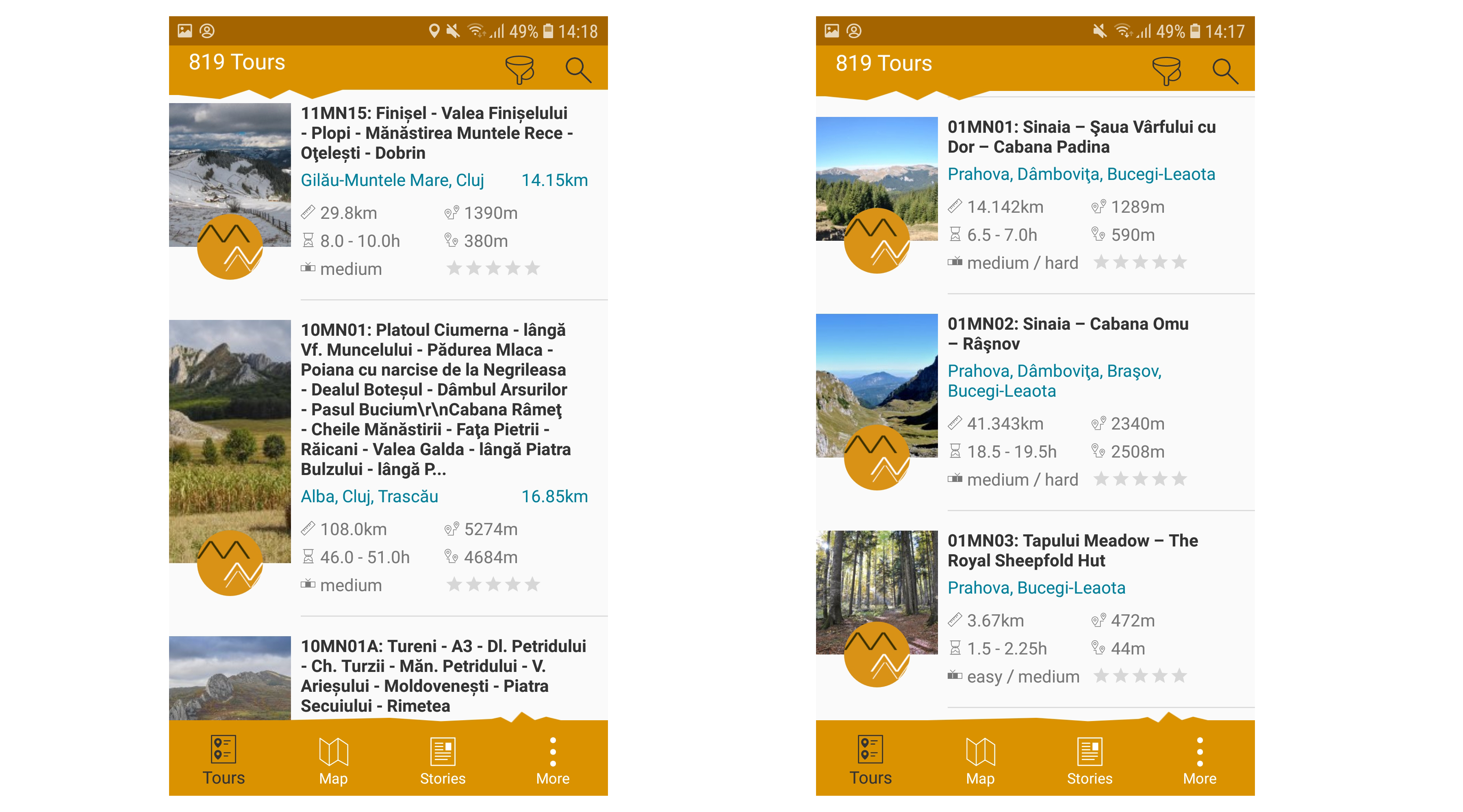
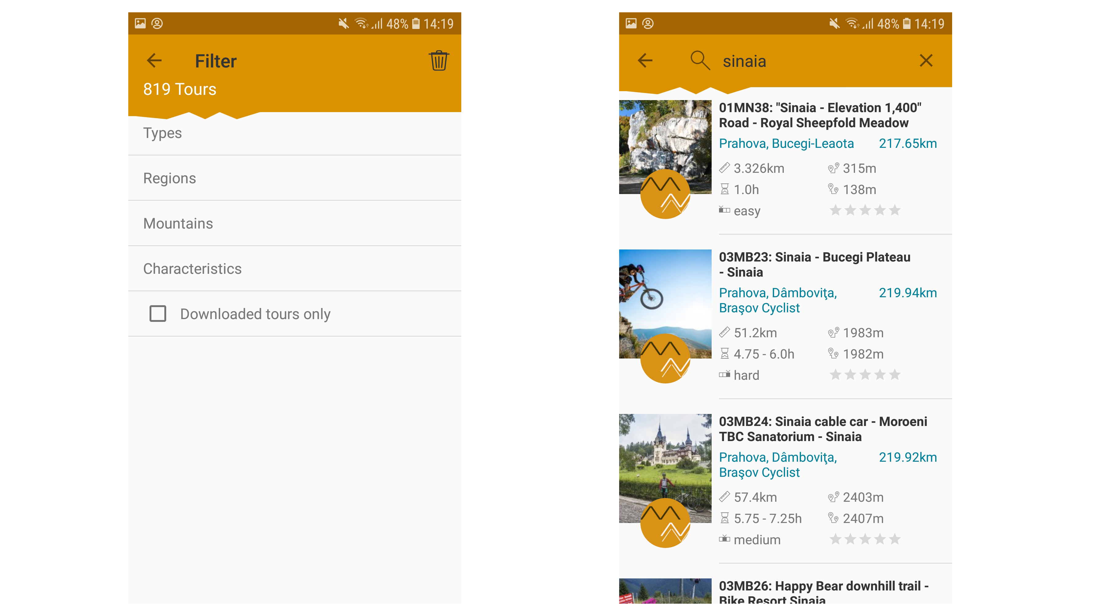
a) After it is installed, the application opens displaying the trails closest to the user’s location (if the GPS is on) or a list of the trails in alphabetical order (if the GPS is off), whether hiking trails, cycling trails and so on. b) To select a specific trail with tourist attractions of interest to you, either use the Filter function or the Search function from the top right. You can filter the trail by type (hiking, cycling, etc.), county, mountain region (e.g. Cozia) or characteristics (difficulty, duration, distance and total ascent). Another possibility is to filter exclusively or together with the trails downloaded on your phone.c) The integrated Search function finds Muntii Nostri trails based on the trail number from the website or using the keywords contained in the name of the chosen trail.
d) Once a trail is selected, the entire trail length is visible on the map. The user can then use the Zoom function and rotate the image in any desired geographical direction.e) When a user downloads a trail, the map of the region where the trail is located is automatically downloaded to view other trails in that region, then the positioning on the map is obtained with the direction of movement (if the GPS is on) and details about elevation, positioning accuracy, and walking speed.
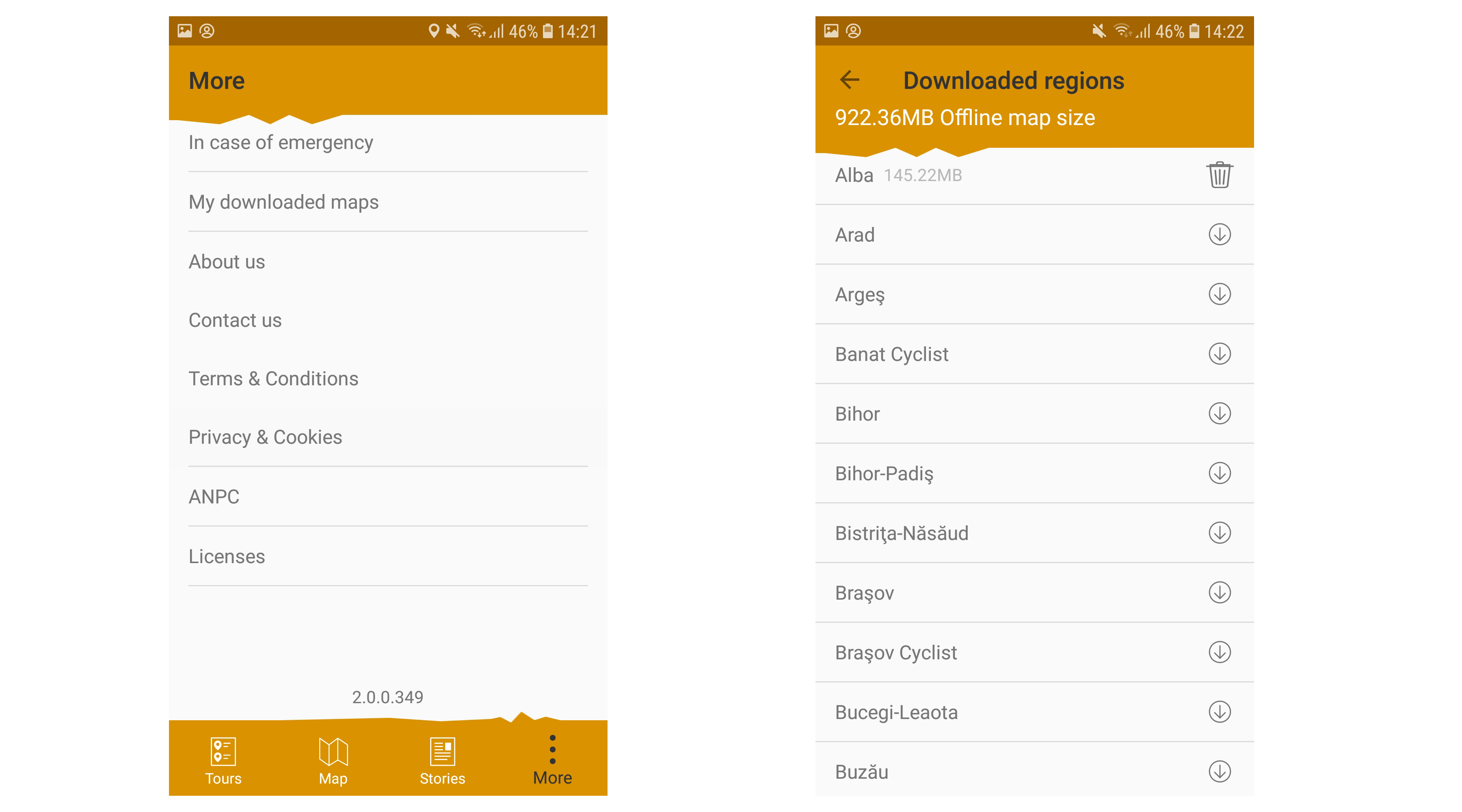
f) The "More" section, represented by 3 vertical points (bottom right), includes a short guide to safety measures and advices for emergency situations, the terms and conditions of the application, and a list of downloaded maps (regions and mountains).g) "My Downloaded Maps" section provides an overview of the downloaded maps and allows the user to download additional maps or delete those that are no longer needed.
It should be understood that the new application comes with digital maps (based on vector layers), correlated with the information provided on the website, complementing the printed maps that can be found in bookstores. All the best and easy hikes!


